On this page
Aurum Press: National Trail GuidesThis page lists National Trail Guides and other walking books published by Aurum Press. The books are arranged by publication date with the most recent at the top.
Aurum Press
There are three Aurum Press pages on the site:
- Bird related books
- National Trail Guides
- other nature books
|
|
|
|
Yorkshire Wolds WayTony Gowers and Roger Ratcliffe
National Trail Guides
Aurum Press
2013
"The Yorkshire Wolds were brought to international attention in 2012 by David Hockney's magnificent Royal Academy exhibition of paintings of the region. Now, Tony Gowers' completely updated, expanded and re-designed National Trail Guide offers the essential companion to the forgotten but fascinating landscape through which this Trail runs. The Trail runs from Hessle in the south, by the Humber Bridge, to Filey on the North Yorkshire coast, through the Wolds' secluded and special dry valleys, a succession of tranquil villages, and past celebrated locations like Thixendale woods now immortalised in Hockney's vast and dazzling paintings. As well as comprehensive route descriptions accompanied by OS 1:25,000 maps, the book features a Philip Larkin Trail around Hull, digressions to the handsome town of Beverley with its beautiful Minster, the Holderness region made famous by Winfred Holtby's South Riding, the seabird colony at RSPB Bempton Cliffs, as well as circular walks to all of the principal locations of Hockney's Wolds paintings. The result is an essential purchase, not just for those walking the Trail, but for every visitor to the area."
|
Buy from amazon.co.uk 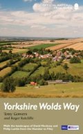
|
|
The RidgewayAnthony Burton
National Trail Guides
Aurum Press
2013
"The Ridgeway follows one of the oldest ‘green roads' in Europe. It runs for 87 miles (140 km) from Overton Hill in the west, across the Marlborough Downs and the Vale of the White Horse, to Ivinghoe Beacon on the northern edge of the Chilterns. This is the complete, official guide for the long-distance walker or the weekend stroller. All you need is this one book. Anthony Burton's official guide has been fully revised and updated for 2013, and this new edition has been completely redesigned with more and bigger photographs and much new background history and information."
|
Buy from amazon.co.uk 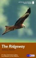
|
|
The West Highland WayAnthony Burton
National Trail Guides
Aurum Press
2013
"The 93-mile West Highland Way is indisputably Britain's most spectacular long-distance path. The first section, following the eastern shore of Loch Lomond, offers an idyllic waterside walk, with the full grandeur of the Highlands gradually revealing itself. Then, after crossing the barren wilderness of the Rannoch Moor, the walker climbs the Devil's Staircase above Glencoe and traverses classic Highland landscapes to reach Fort William and, if he or she wishes, a grand finale at the peak of Britain's highest mountain, Ben Nevis."
|
Buy from amazon.co.uk 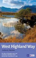
|
|
Wales Coast Path: Tenby-SwanseaChris Moss
National Trail Guides
Aurum Press
2013
"2012 saw the opening of the entire Welsh coastline as an official long-distance footpath. Now, to complement its existing National Trail Guide to the Pembrokeshire Coast Path, which makes up the section of the Path from Fishguard to just beyond Tenby, Aurum publishes a completely new guide to the other most scenic and popular stretch of the Wales coast – the section eastwards from Tenby to Swansea. Starting in the superbly picturesque tourism centre of Tenby itself, Chris Moss's guide follows the coast through Laugharne, famous as the birthplace of Dylan Thomas, Pendine Sands, whose vast level beach was the historic venue for the early attempts on the world land-speed record by buccaneering drivers like Parry-Thomas and Sir Henry Segrave, before winding right round the beautiful Gower Peninsula – an extremely popular holiday destination – before taking in the Mumbles to end in the bustling city of Swansea."
|
Buy from amazon.co.uk 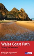
|
|
Northumberland Coast PathRoland Tarr
National Trail Guides
Aurum Press
2013
"The Northumberland coastline stretches from the outskirts of Newcastle up to the Scottish border at Berwick-upon-Tweed – a popular holiday destination for its wild and sweeping landscape of endless beaches of pale sand, succession of spectacular castles like Bamburgh and Dunstanburgh, congenial resorts like Alnmouth, and unique offshore attractions like Holy Island and the Farne Islands. Now, Roland Tarr's new Trail Guide maps out the walker's route along the entire coast, starting from the centre of Newcastle and including an extension beyond Berwick to the seabird crags of St Abb's Head."
|
Buy from amazon.co.uk 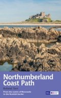
|
|
South West Coast Path: Exmouth to PooleRoland Tarr
National Trail Guides
Aurum Press
2013
"The South West Coast Path is the spectacular 630-mile (1008-km) National Trail around the tip of Britain. This volume features the section of the Path from Exmouth to Poole, a distance of 116 miles (186 km) along the Jurassic Coast, a designated World Heritage Site. Following Natural England's acorn waymarks, the route wends its way along the cliffs, past The Cobb at Lyme Regis and the impressive sweep of the Chesil Beach to Lulworth Cove and Studland Bay. This complete, official guide for the long-distance walker or the weekend stroller has been fully revised and updated for 2013. It has also been completely re-designed, and features many more colour photographs and much more backgrpound information on local history and wildlife."
|
Buy from amazon.co.uk 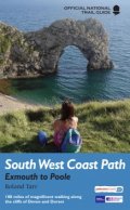
|
|
South West Coast Path: Padstow to FalmouthJohn Macadam
National Trail Guides
Aurum Press
2013
"The South West Coast Path is the longest of Britain's National Trails, following the spectacular coastline for 630 miles around the southernmost tip of England from Somerset all the way to Dorset. This volume of the Official National Trail Guide, published in association with Natural England, features the second section of 169 miles (271 km), from Padstow in north Cornwall to Falmouth on the south coast. From the surfing mecca of Newquay and St Ives's golden beaches it hugs the rugged clifftops round Land's End and the Lizard – as far west and south as it is possible to go in Britain – visiting serpentine harbours and craggy coves such as Cadgwith and Porthcurno with its dramatic open-air theatre. Besides truly wild sea-life like seals and fulmars, the Path offers the only chance anywhere in the country to see the delightful red-beaked chough."
|
Buy from amazon.co.uk 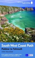
|
|
South West Coast Path: Minehead to PadstowRoland Tarr
National Trail Guides
Aurum Press
2013
"The South West Coast Path is the spectacular 630-mile (1008-km) National Trail around the tip of Britain. This volume features the section of the Path from Minehead to Padstow, a distance of 163 miles (262 km). It skirts the Exmoor National Park, taking in the precipitous harbour towns of Lynton, Lynmouth and Ilfracombe, before heading south-west into Cornwall along the surfers' coast via Westword Ho! and Arthurian Tintagel, to reach the gastronomic mecca of Padstow. Along the way there is the coastal path around Lundy Island, with its puffins, and other arresting wildlife from shearwaters to basking sharks. This guide has been fully revised and updated for 2013, and completely resdesigned to feature many more colour photographs and much more information on local history, cultural associations and wildlife."
|
Buy from amazon.co.uk 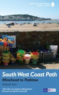
|
|
North Downs WayColin Saunders
National Trail Guides
Aurum Press
2013
"The North Downs Way is the National Trail that follows Natural England's acorn waymarks from Farnham to the coast at Dover. This picturesque Trail takes in chalk ridges, river valleys and sections of the Pilgrims' Way. At the eastern end you can either walk via Canterbury (a total distance of 130 miles, 208 km) or follow the southern route (123 miles, 197 km). This is the complete, fully updated, official guide for the long-distance walker or the weekend stroller. All you need is this one book."
|
Buy from amazon.co.uk 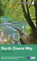
|
|
South Downs WayPaul Millmore
National Trail Guides
Aurum Press
2013
"The South Downs Way runs for 100 miles (160 km) over the chalk downland of Sussex and Hampshire, from Eastbourne to Winchester. It is one of only two National Trails that can be used not only by walkers but also by cyclists and horse-riders for its entire length This is the complete, official guide for the long-distance walker or the weekend stroller. All you need is this one book."
|
Buy from amazon.co.uk 
|
|
Hadrian's Wall PathAnthony Burton
National Trail Guides
Aurum Press
2012
"Since it opened in 2003 Hadrian's Wall Path has become one of Britain's most popular long-distance paths. Its 84 miles are a convenient week's walking, shadowing for the most part the historic line of Hadrian's Wall in its spectacular progress across the superbly wild landscape of the north of England. Starting in what used to be Tyneside's shipbuilding heart, and joining Newcastle in the east with Carlisle in the west, it takes you via the extraordinary Roman forts of Vindolanda and Housesteads, close to handsome towns like Hexham and Corbridge, to finish on the lonely shores of the Solway Firth with views of Scotland."
|
Buy from amazon.co.uk 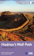
|
|
Pennine WayDamian Hall
National Trail Guides
Aurum Press
2012
"To replace its previous two-volume guide to the Pennine Way, Aurum now publishes an entirely new one-volume guide for the 21st-century walker. The Pennine Way is Britain's toughest long-distance path, running 268 miles from Derbyshire's Peak District up through the Yorkshire Dales, Cumbria and Northumberland into the Scottish Borders. Until now, Aurum's Trail Guide has covered it in two volumes, where our competitors publish one, and those volumes have been bulked out with circular day walks which no-one essaying the arduous task of walking even a stretch of the Path will realistically want to divert to do."
|
Buy from amazon.co.uk 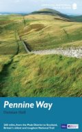
|
|
Pembrokeshire Coast PathBrian John
National Trail Guides
Aurum Press
2012
"180 miles of cliff top, beach and cove around the magnificent Welsh coast, The Pembrokeshire Coast Path (Llwybr Arfordir Sir Benfro) is the 186-mile National Trail around Wales's magnificent southern headland. Winding around the coast from St Dogmaels to Amroth, it clings to soaring cliff tops, seeks out fabulous sweeping beaches like Marloes Sands and Freshwater West, visits lovely towns like St David's and Tenby, castles at Manorbier and Pembroke, and is rich in wildlife from teeming seabird colonies to the rare chough. It is now part of the Welsh Coast Path, fully open in 2012. Whether you're a long-distance walker or a holiday stroller, this is the only book you need."
|
Buy from amazon.co.uk 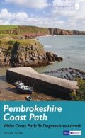
|
|
The Coast to Coast WalkMartin Wainwright
National Trail Guides
Aurum Press
2012
"The classic high-level walk from Irish Sea to North Sea. Originally devised by the legendary Alfred Wainwright, the Coast-to-Coast Walk has steadily become one of Britain's most popular long-distance walks, and it is not hard to see why. Planned to seek out the most spectacular high ground across the country, it takes you from the sea in the west to the sea in the east via three of England's loveliest National Parks: the Lake District, the Yorkshire Dales and the North York Moors. Its 192 miles, from the quiet Cumbrian village of St Bees to Robin Hood's Bay, are a substantial test of endurance that will take even a fit walker a fortnight to accomplish, but also a wonderfully varying walk, from sea cliffs to craggy mountains and lakes, then across rolling dales and finally heather moorland. For everyone who reaches Wainwright's Bar at journey's end on the North Yorkshire coast it will have been the walk of a lifetime."
|
Buy from amazon.co.uk 
|
|
Thames Path: In The CountryDavid Sharp and Tony Gowers
National Trail Guides
Aurum Press
2012
"The official guide to the riverside path from its Gloucestershire source all the way to the outskirts of London. With the London Thames now covered by Aurum's separate new guide, a companion volume can concentrate on the appeal of the full 150 miles of the country Thames, which winds all the way from its Gloucestershire source near Cirencester to Hampton Court on the edge of the London conurbation. This new edition has a wealth of new information about the many sights and places of interest along the way, from Wittenham Clumps that Paul Nash used to paint to Heston Blumenthal's Fat Duck restaurant at Bray, as well as full walking tours of historic Oxford and Windsor & Eton. There are sections on Stanley Spencer at Cookham, and Cliveden and the Cliveden Set, as well as on handsome and interesting towns like Henley and Abingdon. There is also a new section on the wildlife and natural history of the Thames, and plenty of extra information on transport links to and from individual sections."
|
Buy from amazon.co.uk 
|
|
Thames Path: In LondonPhoebe Clapham
National Trail Guides
Aurum Press
2012
"A completely new Trail Guide dedicated to the London section of the Thames Path from Hampton Court to the Thames Barrier. Until now, Aurum's popular one-volume Thames Path guide has had all too little room to cover the endlessly rich array of sights and history along its London section – something to look at literally every yard of the way. Now, Aurum publishes a completely new walker's guide just to the London Thames, laid out to its new full-colour Trail Guide design, and including the extension to Crayford . Here is all the history along the river from the Mesolithic Period timber piles near Vauxhall Bridge to the new Shard skyscraper shooting skywards at London Bridge. It covers all the folklore from the famous frost fairs to the much-lamented beach near Tower Bridge, not forgetting the poignant recent visit of a large whale to the centre of London. The Thames winds all the way through London's history and culture, from Henry VIII's Hampton Court to the chequered fate of the Dome/O2: the London resident as much as the visiting tourist will find in this guide something new every step of the way."
|
Buy from amazon.co.uk 
|
|
The London LoopDavid Sharp and Colin Saunders
National Trail Guides
Aurum Press
2012
"For 140 miles, the London LOOP (London Outer Orbital Path) follows a green corridor right around the capital, offering a circular walk among secret countryside that can make you forget you're within a few miles of Heathrow Airport, the A13, or the suburban sprawl of Croydon, Watford or Dagenham. Here is rolling downland near Coulsdon, the forest of Enfield Chase, the lonely Thames marshes at Rainham, the classical parkland of Bushy Park and a canalside stroll at Uxbridge. London could not seem further away. Each of the guide's 15 sections represents a day's walk of reasonable length, and starts and finishes at a public transport point."
|
Buy from amazon.co.uk 
|
|
The Capital RingColin Saunders
National Trail Guides
Aurum Press
2012
"The Capital Ring is a 75-mile (120 km) walking route encircling inner London that links the astonishing number of islands of green space – parks, woodlands, abandoned railway lines, towpaths and nature reserves – which still survive in the very heart of the city. The Ring takes in many of London's leading attractions – for example, the Thames Barrier, Eltham Palace and Richmond Park – as well as overlooked gems such as Oxleas Meadows, the Parkland Walk and Abbey Mills Pumping Station, and gives a close-up view of the ever-changing Olympic Park. This guide divides the route into 15 sections, each starting and finishing at a public transport point, and is packed with a vast amount of information."
|
Buy from amazon.co.uk 
|
|
Cleveland WayIan Sampson
National Trail Guides
Aurum Press
2012
"The Cleveland Way winds for over a hundred miles around the North York Moors National Park, from the ancient moorland town of Helmsley to finish on the seafront at Filey. Along the way it takes in splendid coastal towns and villages like Staithes and Whitby, wild empty heather moorland, a blaze of purple in late-summer, dramatic coastline and clifftops, and stunning historic sites like Rievaulx Abbey. Whether you're interested in the industrial history of ironstone mining, or a weekend stroller seeking a coastal walk from the seaside resort of Scarborough, this book, published in association with Natural England which waymarks the National Trails, is the only companion you need."
|
Buy from amazon.co.uk 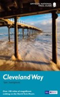
|
|
Peddar's Way and Norfolk Coast PathBruce Robinson and Mike Robinson
National Trail Guides
Aurum Press
2012
"Running 93 miles from the heathland and forest on the Norfolk-Suffolk border, via stunning sandy beaches, picturesque villages and wild, empty salt marsh to the traditional seaside resort of Cromer on the north Norfolk coast, the Peddars Way and Norfolk Coast Path is a wonderfully varied and interesting National Trail. There is the archaeological interest of the Roman road whose route the trail first follows to the coast, the magnificent architecture of Norfolk's characteristic flint churches, and for birdwatchers an embarrassment of riches, from the rare stone curlews of Breckland to the marsh harriers sailing above the reedbeds at the spectacular nature reserves of Titchwell and Cley."
|
Buy from amazon.co.uk 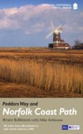
|
|
Cotswold WayAnthony Burton
National Trail Guides
Aurum Press
2012
"Following the limestone escarpment on the Western edge of the Cotswolds, the 102 miles of the Cotswold Way take the walker through a quintessentially English landscape as varied as it is beautiful. Starting and finishing among the golden Cotswold stone of Chipping Camden and Bath, and affording stunning prospects of the Malvern Hills, the Forest of Dean and even the Black Mountains in Wales, it winds through rolling farmland, magnificent beech woodlands, and up over the austerely beautiful Cleeve Hill with its panoramic views out over Cheltenham and far beyond."
|
Buy from amazon.co.uk 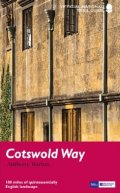
|
|
South West Coast Path: Falmouth to ExmouthBrian LeMessurier
National Trail Guides
Aurum Press
2010
"The South West Coast Path followsBritain's stunning coastline for 630 miles around the southern tip ofBritain. This volume covers the 172 miles of the National Trail along the south Cornwall and Devon coast from Falmouth to the mouth of the Exe. It takes in some of Britain's most popular beaches and resorts, as well as arresting clifftop scenery, romantic coves and the spectacular ‘drowned' estuaries of the Fal, the Yealm and the Dart. Whether you want golden sands, the steep streets of picturesque fishing villages, or a sight of the rare cirl bunting, this book is all you need as your guide to this wonderful walk."
|
Buy from amazon.co.uk 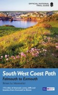
|
|
Offa's Dyke Path: South: Chepstow to KnightonErnie and Kathy Kay and Mark Richards
National Trail Guides
Aurum Press
2010
"Offa's Dyke Path is the 177-mile (283-km) National Trail following the course of the man-made dyke that gives it its name. This volume, now fully updated, features the southern section of the Path, following Natural England's acorn waymarks from Chepstow to Knighton, a distance of 80 miles (128 km). This is the complete, official guide for the long distance walker or the weekend stroller. All you need is this one book."
|
Buy from amazon.co.uk 
|
|
Offa's Dyke Path: North: Knighton to PrestatynErnie and Kathy Kay and Mark Richards
National Trail Guides
Aurum Press
2008
"Offa's Dyke Path is the 177-mile (283-km) National Trail that follows the course of the earthwork that gives it its name. This volume, now fully updated, features the northern section of the Path, following Natural England's acorn waymarks from Knighton to the coast at Prestatyn, a distance of 97 miles (155 km). This is the complete, official guide for the long-distance walker or the weekend stroller. All you need is this one book."
|
Buy from amazon.co.uk 
|
|
Glyndwr's WayDavid Perrott
National Trail Guides
Aurum Press
2004
"This official guide to Glyndwr's Way in Wales contains precise route descriptions and Ordnance Survey maps marked with points of special interest; walks to and from sites off the main route; background information on archaeology, history, wildlife, and geology; details on public transportation and villages on or near the route with facilities for walkers, including accommodations; and a superb selection of color photos."
|
Buy from amazon.co.uk 
|
|
Pennine Bridleway: Derbyshire to the South PenninesSue Viccars
National Trail Guides
Aurum Press
2004
"The Pennine Bridleway, when complete, will run for some 250 miles (560km), and will be Britain's first purpose-built long-distance bridleway. This book covers the southernmost section of the Bridleway, the first to be opened. Starting in the heart of the Peak District, it runs north to the moors of the south Pennines, where it splits to form the 47-mile (75km) Mary Towneley Loop. Although it has been designed and built specifically to serve the needs of horse-riders and cyclists, it is expected that the trail will also be widely used by many walkers as it is easily accessible from the towns and cities of north-west England."
|
Buy from amazon.co.uk 
|
|